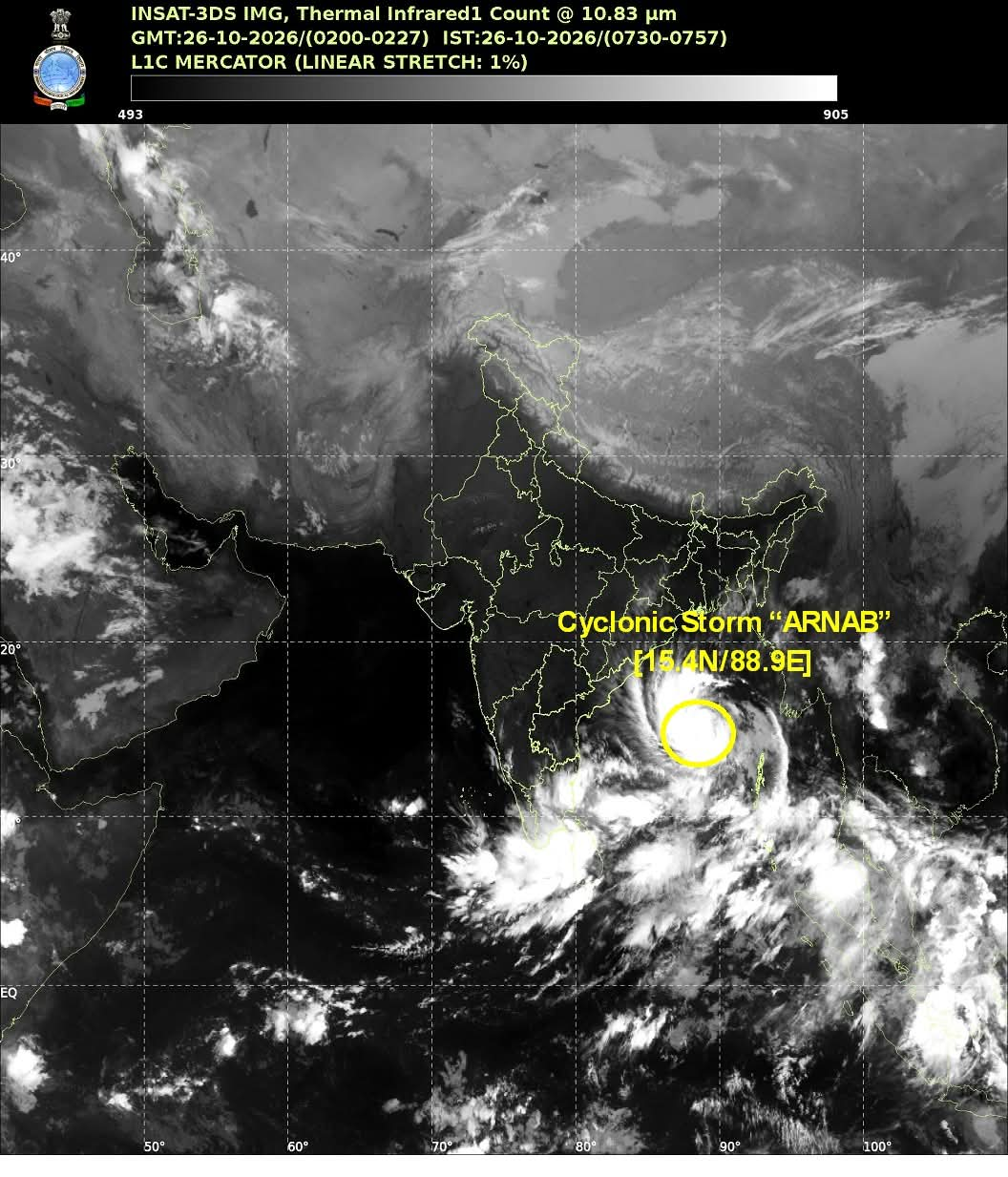
NEW DELHI: Cyclonic Storm Arnab has intensified over the eastcentral and adjoining westcentral Bay of Bengal, prompting heightened weather warnings for the Andhra Pradesh and adjoining south Odisha coasts.
The India Meteorological Department (IMD) has warned that the system is likely to intensify into a very severe cyclonic storm before crossing the Andhra Pradesh coast on October 28.
According to the IMD’s latest update provided for 5.30 am IST on Monday, October 26, Cyclone Arnab was centred near latitude 15.4°N and longitude 88.9°E. The storm was moving westwards at approximately 15 kmph during the preceding six hours.
At the time, its centre was about 590 km northwest of Sri Vijaya Puram in the Andaman and Nicobar Islands, 650 km east-southeast of Visakhapatnam, 730 km east-southeast of Kakinada, 830 km east of Machilipatnam and 910 km east of Bapatla in Andhra Pradesh.
The IMD has forecast that Cyclone Arnab will move west-northwestwards and intensify into a severe cyclonic storm over the westcentral Bay of Bengal by midnight on October 26.
The system is then expected to strengthen further into a very severe cyclonic storm on October 27 as it moves towards the Andhra Pradesh coast.
According to the forecast, the cyclone is very likely to move northwestwards and cross the Andhra Pradesh and Yanam coasts between Bapatla and Visakhapatnam by the forenoon of October 28.
At landfall, the storm is expected to pack maximum sustained wind speeds of 115–125 kmph, with gusts reaching up to 140 kmph.
The approaching cyclone poses a significant threat to coastal districts of Andhra Pradesh and adjoining areas of southern Odisha. Heavy rainfall, very strong winds and rough sea conditions are among the major hazards associated with the system.
The IMD has issued a cyclone warning for the Andhra Pradesh and adjoining south Odisha coasts. Fishermen and coastal communities have been advised to follow official weather advisories and avoid venturing into the sea during the period of severe weather.
The IMD’s tropical weather outlook has also highlighted the possibility of a storm surge of around 1.0–1.5 metres above the astronomical tide in low-lying areas near Kakinada and Yanam districts during landfall.
Such a surge could result in inundation of vulnerable coastal stretches, making preparedness, timely warnings and evacuation arrangements particularly important.
Authorities urged to remain prepared
With the cyclone expected to approach the coast within the next two days, disaster management authorities and district administrations face a critical period for preparedness.
Coastal residents should monitor official IMD bulletins, follow instructions issued by local administrations and avoid unnecessary movement during periods of strong winds and heavy rainfall.
The cyclone’s intensity, movement and exact landfall conditions will remain subject to further updates from the Meteorological Department.